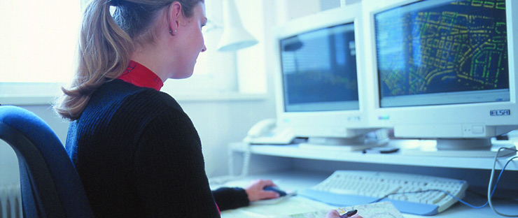
GeoinformationstechnikerIn
© AMS / DoRo Filmproduktion

Apprenticeship (Lehre ) Surveying and geoinformation technician, focus on geoinformation technology
(Vermessungs- und GeoinformationstechnikerIn, Schwerpunkt Geoinformationstechnik)

Warnung Translated by Google Translation API
The text was automatically translated from German. The German terms are shown in brackets.
THIS SERVICE MAY INCLUDE TRANSLATIONS PROVIDED BY GOOGLE. GOOGLE DISCLAIMS ANY LIABILITY WITH RESPECT TO TRANSLATIONS, EXPRESS OR IMPLIED, INCLUDING ANY LIABILITY FOR ACCURACY, RELIABILITY AND ANY IMPLIED LIABILITY FOR MARKET EFFICIENCY AND DISCLAIMER.

Der Text wurde automatisiert aus dem Deutschen übersetzt. Die deutschen Begriffe werden in Klammern angezeigt.
DIESER DIENST KANN ÜBERSETZUNGEN ENTHALTEN, DIE VON GOOGLE BEREITGESTELLT WERDEN. GOOGLE SCHLIEßT IN BEZUG AUF DIE ÜBERSETZUNGEN JEGLICHE HAFTUNG AUS, SEI SIE AUSDRÜCKLICH ODER STILLSCHWEIGEND, EINSCHLIEßLICH JEGLICHER HAFTUNG FÜR DIE GENAUIGKEIT, ZUVERLÄSSIGKEIT UND JEGLICHE STILLSCHWEIGENDE HAFTUNG FÜR DIE MARKTGÄNGIGKEIT, EIGNUNG FÜR EINEN BESTIMMTEN ZWECK UND NICHTVERLETZUNG FREMDER RECHTE.

What does a Surveying and geoinformation technician, focus on geoinformation technology do?
(Was macht ein/eine Vermessungs- und GeoinformationstechnikerIn, Schwerpunkt Geoinformationstechnik?)

  • Create and revise maps and plans Create thematic maps in which additional information such as vegetation zones, population density or transport network is drawn Work with geodata such as survey data, aerial photographs and satellite images Use digital techniques to display surface information and terrain details Design maps using special computer programs, e.g. with CAD software Prepare maps for printing, e.g. road maps, city maps, school atlases Manage and save data in geographic information systems (GIS) Edit templates for implementation in other media, e.g. for interactive maps on the Internet


  • Landkarten und Pläne erstellen und überarbeiten
  • Thematische Karten erstellen, in denen Zusatzinformationen wie Vegetationszonen, Bevölkerungsdichte oder Verkehrsnetz eingezeichnet werden
  • Mit Geodaten wie Vermessungsdaten, Luftaufnahmen und Satellitenbildern arbeiten
  • Digitale Techniken anwenden, um Oberflächeninformationen und Geländedetails darzustellen
  • Karten mit Hilfe von speziellen Computerprogrammen gestalten, z. B. mit CAD-Software
  • Karten für den Druck vorbereiten, z. B. Straßenkarten, Stadtpläne, Schulatlanten
  • Daten in Geoinformationssystemen (GIS) verwalten und sichern
  • Vorlagen für die Umsetzung in anderen Medien bearbeiten, z. B. für interaktive Karten im Internet

Where does a Surveying and geoinformation technician, focus on geoinformation technology work?
(Wo arbeitet ein/eine Vermessungs- und GeoinformationstechnikerIn, Schwerpunkt Geoinformationstechnik?)

  • Cartographic institutes Publishers Public service, e.g. B. Federal Office of Metrology and Surveying or in regional planning

  • Kartografische Anstalten
  • Verlage
  • Öffentlicher Dienst, z. B. Bundesamt für Eich- und Vermessungswesen oder in der Landesplanung

What excites me and what am I good at?
(Was begeistert mich und was kann ich gut?)

(frequently mentioned requirements in job advertisements for apprentices) ((häufig genannte Voraussetzungen in Stelleninseraten für Lehrlinge))
  • Enthusiasm for graphics and design (Begeisterung für Grafik und Design)
  • Enjoy working on the computer (Gerne am Computer arbeiten)
  • Basic knowledge of IT (Grundkenntnisse in EDV)
  • Good knowledge of mathematics (Gute Kenntnisse in Mathematik)
  • Good spatial awareness (Gutes räumliches Vorstellungsvermögen)
  • Sense of color (Sinn für Farben)
  • Sense of shape (Sinn für Formen)
  • Sense of precise work (Sinn für genaues Arbeiten)

How long does the apprenticeship take?
(Wie lange dauert die Lehrzeit?)

  • 3 years
    (3 Jahre); Shortened apprenticeship for people with a degree: 2 years (verkürzte Lehrzeit für Personen mit Ausbildungsabschluss: 2 Jahre )

Search and find apprenticeships
(Lehrstellen suchen und finden)

Currently there are (Aktuell gibt es) 1 vacancies (offene Stellen)to the AMS eJob Room ( zum AMS-eJob-Room)

Austria map of job vacancies (Österreich-Karte der offenen Stellen)

Österreich Karte

How much does a/an Surveying and geoinformation technician, focus on geoinformation technology earn during the apprenticeship?
(Lehrlingseinkommen)

Further information, including different regulations per federal state and any special regulations: (Weitere Informationen, u. a. zu abweichenden Regelungen pro Bundesland und etwaigen Sonderregelungen:) about the AMS- Berufslexikon (zum AMS-Berufslexikon)

Where are vocational schools?
(Wo gibt es Berufsschulen?)


What interests me and what personal qualities should I bring with me?
(Was interessiert mich und welche persönlichen Eigenschaften sollte ich mitbringen?)

Interests
(Interessensgebiete)

  • Construction, wood, building technology (Bau, Holz, Gebäudetechnik) Requirements open / close (Voraussetzungen Öffnen/Schließen)
  • Computer, IT, EDP (Computer, IT, EDV) Requirements open / close (Voraussetzungen Öffnen/Schließen)

Personal characteristics
(Persönliche Eigenschaften)


What does my work environment look like?
(Wie sieht mein Arbeitsumfeld aus?)

Work environment
(Arbeitsumfeld)


What jobs can I do with the apprenticeship?
(Welche Berufe kann ich mit der Lehrausbildung ausüben?)

More job information
(Weitere Berufsinfos)

Related apprenticeships and crediting
(Verwandte Lehrberufe und Anrechnung)

Related apprenticeship occupation (Verwandter Lehrberuf)Credit after (Anrechnung nach dem)
1. Apprenticeship year (1. Lehrjahr) 2. Apprenticeship year (2. Lehrjahr) 3. Apprenticeship year (3. Lehrjahr) 4. Apprenticeship year (4. Lehrjahr)
Construction draughtsperson (BautechnischeR ZeichnerIn) voll
Technical draftsperson (TechnischeR ZeichnerIn) voll

Replacement of the final apprenticeship examination
(Ersatz der Lehrabschlussprüfung)

The final apprenticeship examination in the apprenticeship ' Vermessungs- und GeoinformationstechnikerIn, Schwerpunkt Geoinformationstechnik ' does NOT replace an apprenticeship final examination in related apprenticeships.

(Die Lehrabschlussprüfung im Lehrberuf "Vermessungs- und GeoinformationstechnikerIn, Schwerpunkt Geoinformationstechnik" ersetzt KEINE Lehrabschlussprüfung in verwandten Lehrberufen.

)

Allocation to AMS occupational classification (six-digit)
(Zuordnung zu AMS-Berufssystematik (Sechssteller))

  • 680682 Surveying/geoinform. technician - geoinformation technology (Vermess.-/Geoinform.techniker/in - Geoinformationstechnik)

Type of apprenticeship
(Lehrberufsart)

Schwerpunkt-Lehrberuf

Apprenticeship status
(Lehrberuf Status)

current (aktuell)

Designation according to the list of apprenticeships or training regulations
(Bezeichnung laut Lehrberufsliste bzw. Ausbildungsordnung)

Vermessungs- und Geoinformationstechnik - Geoinformationstechnik

Obsolete apprenticeship titles
(Veraltete Lehrberufsbezeichnungen)

  • GeoinformationstechnikerIn (valid until (gültig bis ) 30. Juni 2024)

This apprenticeship was updated on 20. Juni 2025 . (Diese Lehre wurde aktualisiert am 20. Juni 2025.)

This page was updated on: (Diese Seite wurde aktualisiert am:) 07. August 2025 V2.9.0.0